Grist Mill GPX Download Updated!


Updated Version (April 2012) Ready In The Downloads Window!

There is a new updated version of the Grist Mill GPX file available in the Downloads area on the right side menu!  I have added all of the Ohio and Indiana mills plus made repairs to older entries that proved to be incorrect!  Please download them and install on your GPS!

As ALWAYS please share the lat/long, name, location, address and description of any mills that you find that are NOT on this download!!

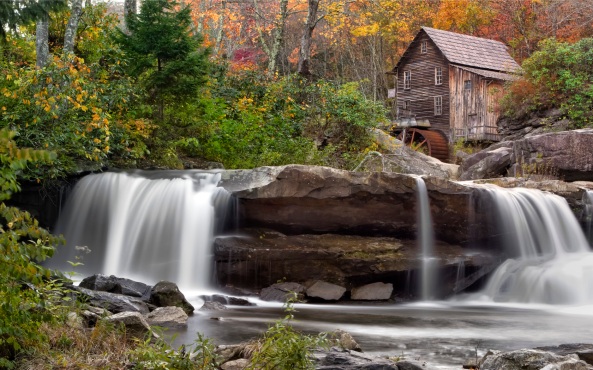
Glade Creek Grist Mill, WV

Thanks for your continued help.

The Hammond & Gilbert Mills In Rhode Island


The Gilbert Stuart Museum & Mills

In Color, Infrared and B&W

The Hammond & Gilbert Mills

The Hammond & Gilbert Mills

The Hammond Mill, Selective Focus

I would like to draw your attention to a specific Grist Mill in Rhode Island!  This is the Hammond and Gilbert Mills at the Gilbert Stuart Museum.  What is so unusual about them is the fact that they are 50 feet apart on the same creek feed!  The Gilbert Mill was a Snuff Mill with living quarters for the family above the mill.  The Hammond Mill is and was a standard Grist Mill.  Both Mills are in AMAZING condition and the location just screams “Photograph Me“!    Location is a little in the back country but well worth the drive.  If you would like directions then download the Mills GPX file in the download window to the right!

The Gilbert Mill

The Mills are full of promise!  Look for detail shots as well as wide angle shots.  If you arrive mid day then you will likely be only able to shoot in Infrared (hey, not exactly a bad thing, you think?)  I think that early morning would be the best.  There is a nice standing pond behind the mills for reflection shots and the water path below the mills is actually a fish ladder to aid in migration! As I said, VERY PRETTY!

I shot these images using a Panasonic GH2 Micro 4/3 camera body (Color) and the Pansaonic 14-140mm lens.  For the Infrared shots I used my Olympus E-PL1 Full Spectrum Infrared camera body with the Olympus 14-150mm lens and an external (on the lens) B+W 091 630nm IR filter.  Since the previous post has a lengthy description and recipe for post processing these IR images I am going to leave the same out of this post!

Again, I am going to place all of the images of these amazing mills in a photo album below and all you have to do is to click on any image to bring up the slide show!

_____________________

_____________________

I hope that you enjoy this collection of a VERY unusual Mill!  

Please let me know what you think!

Photographic Notes Page


I have added a new Photographic Notes page!

Plan and turn this SUBJECT into...

This is a new section designed to document and teach basic photographic planning, destinations, composition while also providing subject location information!  The data here is neither Infrared or Color specific… Rather it is Photography specific!  It is how I plan and document my photographic journeys. I hope that you enjoy and are able to use this information. To access it simply click on the NOTES menu button on the top of this page then select the drop down menu item that interests you!

I normally keep my notes on an Apple iPad (1) using an application called Penultimate which is the best and most versatile note and image writing tool that I have found for the Apple family of portable devices.

INTO THIS!

Added Grist Mill GPX and Covered Bridge GPX Updated Files!


Go Get Them!

Glade Creek Mill, WV

There are two new downloads for your GPS system in the download box!  I added the Covered Bridges in Georgia and several NEW and corrected Grist Mill locations!

These are in the GPX file format and can be downloaded from here from the download menu on the lower right menu.

Once you have them on your computer you will need to have the GPS software that camera with your personal GPS to download them into your GPS.

Once done they will be available for you while you travel around the country!

As Always, I would appreciate ANY help that any of your could offer in expanding this database!  So far there are 185 Grist Mill locations and I would like to double that by the end of the year.

Send the following information to have it included in the Database:

  • Mill or Bridge name
  • Address
  • State
  • Lat/Long (IMPORTANT)
  • Description
  • Info on ownership and contact info if on private property.
  • You name and email
  • Best time of day and season for photographing them
  • Image if possible

2 New GPX Files Added To Download Area


Downloadable GPS Data Files Added!

i have moved the first versions of the Grist Mill and Covered Bridges GPX files to the download area (right hand menu system).  These files (once downloaded to your computer) can be opened in your GPS management software installed on your computer and sent to your GPS unit that you use in your car!  All of the GPS products out there have management software to do this in both the Mac and PC world!

Please feel free to send me your input to this list and I will update them from time to time!


The Grist Mill Trip – Day 2 Covered Bridges & Farms


Amish Country – Lancaster County, PA

630nm Covered Bridge, Lancaster, PA


Today we drove about 4 hours east to Lancaster, PA.  The point being to visit Covered Bridges, Farms and the Amish people who reside there.  I grew up in the Amish community of Lexington, Ohio and have a good knowledge of the people and their customs and was very excited to visit an area where they reside!

I didn’t expect to see any grist mills today and didn’t really look.  In truth, there are about 30 of them in Lancaster!  But, they are all ugly boxy white buildings with no external water wheel assembly.  They are common on the larger farms but not really worth seeking out.

Lancaster Covered Bridge

I have always enjoyed seeing covered bridges.  They like grist mills are a reminder of times past.  But I didn’t realize how fast I would grow bored with them!  That may sound terrible, but to me here in Lancaster, they just all look the same.  The only real differences were the surrounding trees, their length and the walls, fences or guard rail leading up the their entrances!  Plus we arrived mid afternoon with a BRIGHT white sky and color photography was very difficult.  I even had some issues with them in Infrared!  This is not to say that I didn’t walk away with some nice images, but I could have done much better in the early morning.

The other difficulty in photographing these bridges is that they are hard to find.  All of the web sites direct you to them via a convoluted series of turns and roads.  Not ONE gives an address OR a GPS Lat/Long string which would make it much easier to find them!

All told, we visited 7 bridges here.  They were interesting but most were impossible to get a side angle on for a good photograph.  I still think that they are a worthwhile subject, but one that will require much more research.  They also are a little more interesting when shot in COLOR. I am not going to talk about the Infrared Post Processing since these images are basically the same as the ones in Day 1!  But, the color images while simple really need a small discussion:

Basic Color PP Recipe

Photoshop CS5 with NIK Viveza and Color EFX Pro

  1. Delete marginal, duplicates and bad images!
  2. Convert from RAW to TIFF using Capture One V6
  3. Open in CS5
  4. Crop to standard storage size: 8.5 x 12.5 (the extra .5 is for underlay with the mat.
  5. Run NIK Define 2.0 on images with skies.
  6. Run NIK C0lor EFX Pro color contrast range preset and adjust as necessary.
  7. Run NIK Viveza to adjust various image component brightness (tress and such).
  8. Save as a PSD file.

Lancaster Covered Bridge, Side View

That is it.  Each image only takes about 1 min from start to finish.  You really will like the ease that the NIK plugins give you in processing.  Plus the NIK tools work equally as well in Photoshop Elements!  What more could you ask for?

Take a look at these images and try to decide if you like the Color or Infrared versions better.  For me I almost always will pick the IR version but in the case of the Covered Bridges I like the Color versions a little better!

Lancaster Covered Bridge, Entrance

Lancaster Covered Bridge, Inside Detail, Color

Lancaster Covered Bridge, 630nm B&W

Lancaster Covered Bridge, Color

Lancaster Covered Bridge, 630nm

Lancaster Covered Bridge, 630nm B&W

Have you noticed a pattern with my Infrared photography?  I seem to be spending much more time shooting with the 630nm (B+W 091) filter all of the time.  I do like the 590nm (B+W090) and a 665nm (more pinks and reds) as well as the R72 720nm Hoya filter.  But for most of my work I am getting stunning Faux and nice contrasty B&W from the 630nm.  I like the post processing from this filter as well because it gives me the ability to generate different hues in the tree leaves depending upon the type of tree!

Lancaster Covered Bridge, Long View

All of the bridges were within a 10 mile square and still difficult to locate.  I do feel them to be worth the effort and hope that if you get the chance to see them that you give them a chance!

OK, on to Amish Farm Country!

Working The Fields

They are a very interesting group of people and I admire their fortitude in sticking to their beliefs.  I saw hundreds of horse and carriages on the roads.  I saw small red wagons being drawn by a small pony.  Lots of field equipment behind teams of horses.

Typical Amish Farm

The farms were beautiful but small (as you would think being worked by horse power).  Kids were out playing and riding a bicycle like device with no seat and peddles.  It did have a front turn able wheel and handle bars with full size tires but they stood on it and pushed with their feet!

Cool Rest

We didn’t stay more than a few hours as I was very tired and wanted to get closer to my next main destination which meant another 4 hours of driving east thru Philly and then finding a hotel for the night so that I could be there early in the morning.  Yes, I actually did plan on this stop for early AM!

So the next post for Day 3 Is Cutalossa Farm East of Phili about 10 miles.  I can tell you that this stop will turn out to be the best stop of the entire trip!

Stay Tuned!